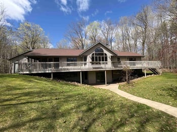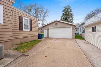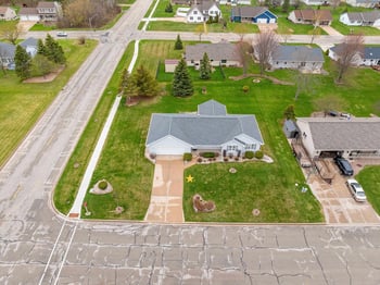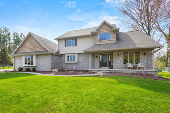

Around Green Bay, waterfront real estate isn’t one lifestyle. A home on the Fox River lives differently than a place on the bay, and both feel different than a quiet stretch of creek or a neighborhood pond. If you’re buying here—especially if you’re relocating—the smart move is to look past the photo. You want to understand what your daily routine feels like in July, what your yard does during spring melt, and what’s still comfortable on a windy February morning.
If you’re still getting oriented to the area first, start with our Green Bay real estate guide and then come back here to narrow down which type of waterfront actually fits your day-to-day.
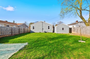
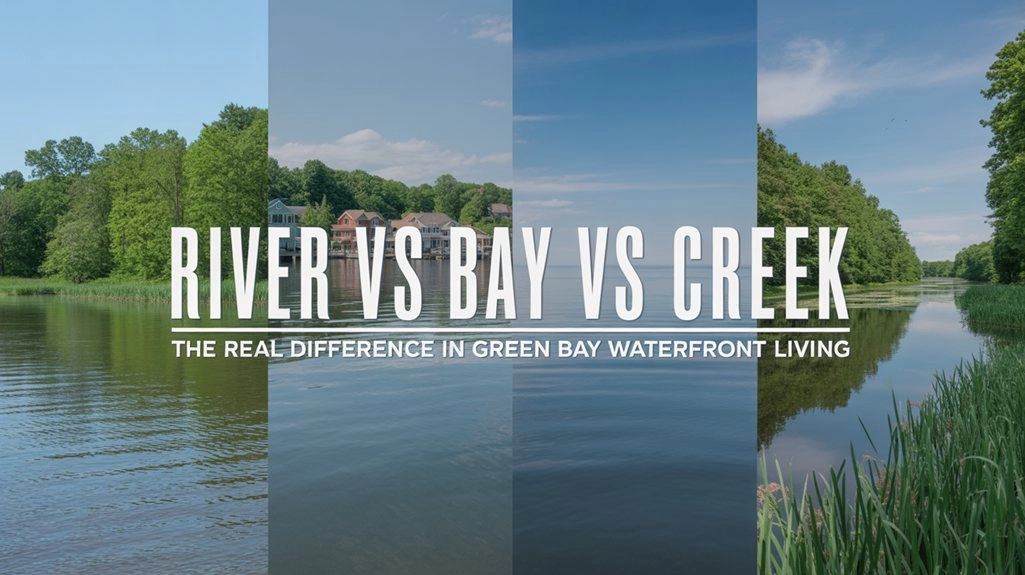
Treat waterfront as a “type,” not a single feature. The waterbody and the lot’s exposure usually predict the day-to-day: privacy, wind, bugs, yard softness, and what improvements you can realistically make later.
Fox River frontage is the classic “active river” version of waterfront in this area. In many stretches, you’re close to the Fox River State Recreational Trail, which is part of how people actually use the river corridor year-round—walks, runs, bikes, and quick after-dinner loops. That can be a lifestyle plus, but it also changes privacy and noise patterns depending on how close you are to access points. (Brown County: Fox River State Recreational Trail)
East River frontage often reads as quieter and more wooded in feel, especially where the East River Trail runs close to the water through Green Bay, Bellevue, Allouez, De Pere, and Ledgeview. It’s useful context because a trail isn’t just recreation—it’s a privacy and predictability factor for waterfront real estate. (TrailLink: East River Trail)
Creek frontage is the category that surprises buyers the most. It can be peaceful and natural, but it can also behave like a drainage feature during heavy rain and spring melt. In the Howard area, you’ll see local discussion about Duck Creek conditions for kayaking, which is a good reminder that small water moves differently depending on season and rainfall. The buyer move is to assume the creek has “storm behavior” until mapping, grade, and on-the-ground clues say otherwise. (Local discussion: Duck Creek conditions)
If you’re specifically drawn to that quieter creek-and-pond style of waterfront living, you’ll usually find more options by looking at Howard & Suamico real estate in addition to the city limits.
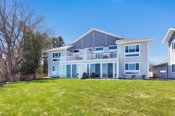
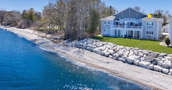
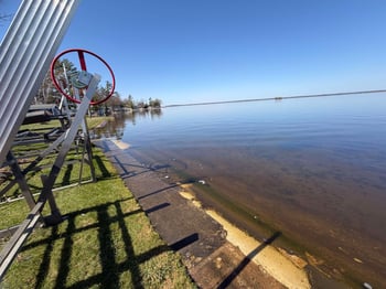
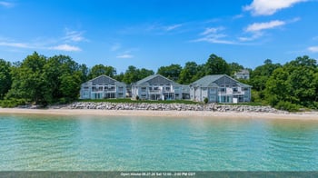
Bayfront is the “open exposure” version of waterfront. It can be beautiful, but wind and winter conditions tend to be part of the package. The simplest difference most buyers feel is this: protected river edges can be calm when the bay is raw. That changes how often you sit outside, how snow drifts on the property, and how safe steps and walkways stay through freeze-thaw cycles.
On open-water shorelines around Green Bay, ice can pile and push in ways protected river edges don’t see. The point isn’t to worry—it’s to notice exposure and whether the shoreline has been reinforced for that kind of season. Regional reporting on ice hazards also shows how quickly conditions can shift when wind changes. (FOX11: ice rescue on Green Bay)
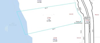
Pond-front real estate can be calm and easy, but you want to know whether it’s a natural pond or part of a stormwater system. That difference affects mowing rules, fencing, shoreline plantings, and who maintains what. For contrast, places like Duck Creek Quarry Park show how managed water works when a municipality owns it—private lots usually have a different rules setup tied to easements or an HOA. (Village of Howard: Duck Creek Quarry Park)
People shop waterfront for the view, but they live with the patterns: how often you hear activity, how usable the yard is on a normal weeknight, and how the property behaves when weather turns.
If you’re near a trail segment, your “quiet” will be different than a private shoreline. The Fox River State Recreational Trail and the East River Trail are real lifestyle perks, but they also create predictable foot and bike traffic patterns. (Brown County: Fox River State Recreational Trail)
Ask a direct question early: “Is there a public easement, trail right-of-way, or common access point near this shoreline?” Two waterfront homes can look similar online and feel completely different if one sits next to a trail spur, a fishing pull-off, or a shared access strip.
Still water and slow water typically bring more mosquitoes in warm months, and shoreline vegetation can be both a privacy benefit and a maintenance reality. On creeks and wetter edges, expect a bigger spring “soft season” than you’d get on a higher, drier lot. If you’re sensitive to upkeep, this is where waterfront type matters more than the view.
A practical test: can you picture yourself using the yard on a normal weeknight, not just a perfect weekend? A deck can feel great on a calm summer evening and still end up underused if the lot takes full wind off the bay. River and creek lots can feel more sheltered, but they may come with softer ground and more shoreline change to monitor over time.
Winter is when waterfront living becomes a comfort and access decision, not just a view. If winter is your biggest question, read this alongside how to choose a Green Bay location that stays easy in winter so your decision holds up beyond one season.
Bay-facing lots tend to feel more exposed. That can mean drifting, icy patches near doors and steps, and fewer comfortable outdoor minutes unless wind protection is part of the property layout. Indoors, wind can make a drafty house feel noticeably colder, especially at night.
The winter shoreline story is different on open water than it is on a protected river bend. On the bay, ice can build and move with wind shifts. On rivers, the concern is often spring break-up and what it does to banks, landscaping, and the edge of the yard.
Waterfront steps and walkways can ice over faster because of wind and moisture. Snow also has to go somewhere. On tighter waterfront lots, you want a plan for snow storage that doesn’t block paths, bury outdoor equipment, or push meltwater toward the foundation in spring.
You don’t need a storm-day showing to learn a lot. Most properties leave clear clues about drainage and shoreline stability if you know what to look for.
Waterfront doesn’t automatically mean water problems. It does mean the drainage plan should be clear, and the shoreline should look stable and maintained on purpose.
Look sideways, not just straight out at the water. If nearby lots have rock reinforcement, retaining edges, or thicker shoreline plant buffers, it’s usually a response to a real behavior pattern. You don’t have to copy it, but you should understand what it’s protecting against and whether your lot has the same exposure.
When a yard stays soft long after rain, soil and wetland mapping often explain why. Wisconsin’s wetland inventory guidance is a useful planning tool for early screening, even though final determinations are made on-site. (Wisconsin DNR: Wetland Inventory)
If you’re deciding between two waterfront homes, run the same five checks on both addresses. The better day-to-day fit usually becomes obvious.
Do these checks before you commit. They’re practical, they’re fast, and they reduce the odds of discovering later that “waterfront” comes with rules, limits, or property behavior you didn’t plan for.
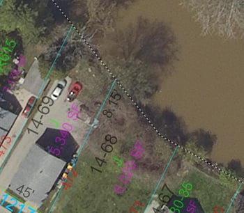
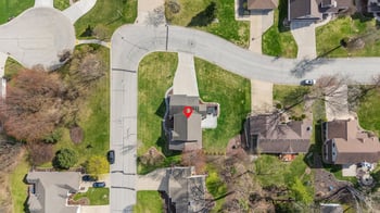
Start with Brown County’s parcel/GIS map to see parcel lines, aerials, and context listing photos rarely show. It’s also one of the best ways to spot mapped easements or zones that affect what you can do near the water. (You may see it referred to as “BrownDog” in local circles.) (Brown County GIS map)
Run the address through FEMA’s Flood Map Service Center. Flood mapping can affect insurance, lender requirements, and what future work is allowed—even if the home sits higher than the waterline you see today. (FEMA Flood Map Service Center)
Wisconsin DNR tools help you stop guessing. The Surface Water Data Viewer provides waterbody context, and the Storm Water, Waterway and Wetland Permit Viewer can surface past permits and screening that often correlates with what you can change near the shoreline. (DNR Surface Water Data Viewer)
Confirm whether the parcel is in the City of Green Bay, another city/village, or unincorporated Brown County. That determines which zoning standards and shoreland rules apply near the water. Brown County provides guidance for shorelands, wetlands, and floodplains. (Brown County: Shorelands, Wetlands, and Floodplains)
If you’re picturing a dock, steps, riprap, a wall, or shoreline clearing, treat that as a separate decision. Older shoreline work is not always something you can expand just because it exists. Screenshot the zoning layers for the parcel and cross-check DNR permit history so you know what is allowed, what was previously approved, and what would require new review.
For lots that stay wet, soil data often explains why. USDA Web Soil Survey is one of the more useful early checks for creek frontage and lower yards because it relates directly to drainage and seasonal wetness. (USDA Web Soil Survey)
If the property isn’t on municipal sewer, add one more practical question: where the septic system sits relative to the shoreline, and whether the lot has enough usable area for a future replacement if needed. On smaller waterfront lots, that single detail can shape long-term options.
Waterfront homes can be easy to say yes to. This short list keeps the decision grounded: confirm school boundaries by address, run your commute at the hours you actually drive, and use local tools to understand incident patterns in the area you’re considering.
Boundaries can change, so “it should be this school” is not a safe assumption. Green Bay Area Public School District provides a boundary locator for address-based checks, and De Pere schools provide boundary guidance as well. (GBAPS: Boundary Locator) (De Pere: Boundaries, Maps, Busing)
Run a drive-time snapshot before you buy. Use your normal departure windows and test the routes you would rely on most, especially if you’ll be doing regular trips to downtown Green Bay, De Pere, or Ashwaubenon for work, events, or appointments.
For neighborhood-level awareness, use mapping tools that allow address searches and incident filtering. Community Crime Map is a commonly used public tool tied to law enforcement reporting, and Brown County Sheriff’s Office provides official links and resources that can help you verify what applies in the area you’re considering. (Community Crime Map) (Brown County Sheriff: Links & Resources)
The best waterfront choices around Green Bay come from matching the water type to the life you actually want. Once you know whether you’re choosing a river edge, open bay, creek, or pond frontage—and you’ve verified rules and lot behavior by address—the decision starts to feel calm and predictable instead of guessy.